UAV Photogrammetry Surveys UK - Drone Mapping for Property and Development
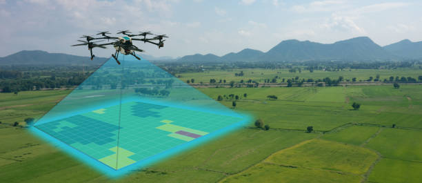
UAV photogrammetry surveys use drone-captured overlapping photographs to create accurate maps, 3D models and measurable datasets of land, buildings and development sites. Across the UK, the technology is used by property developers, landowners, investors, surveyors and construction teams for topographical mapping, site surveys, development planning, progress monitoring and property due diligence.
By processing large numbers of georeferenced aerial images, UAV photogrammetry can produce detailed digital information without relying exclusively on conventional ground surveying. It is particularly useful for large sites, complex buildings and locations where obtaining comprehensive ground-level information can be difficult.
FraserBond.com supports developers, investors and landowners with development site sourcing, property acquisitions, sales, lettings, compliance-focused property support and investment advisory across London and the wider UK market.
What Is a UAV Photogrammetry Survey?
A UAV photogrammetry survey involves flying a drone over a property or area while capturing multiple overlapping photographs from carefully planned positions.
Specialist photogrammetry software identifies common points across these images and uses them to reconstruct the site digitally.
Depending on the survey specification, outputs can include:
- Orthomosaic maps
- 3D point clouds
- Digital surface models - DSM
- Digital terrain models - DTM
- Contour information
- 3D mesh models
- Elevation information
- Volumetric calculations
- CAD and GIS-compatible datasets
The accuracy and deliverables required should be established with an appropriately qualified survey professional before the flight takes place.
UAV Photogrammetry for Property Development
Drone photogrammetry for property development can provide detailed existing-site information during the early stages of a project.
Developers can use processed aerial data to understand the relationship between land, buildings, access routes and surrounding features.
This can support feasibility work, architectural design, engineering and construction planning.
For larger developments, having an accurate digital representation of the existing site can also improve communication between consultants working on different parts of the project.
Through FraserBond.com, developers can identify and evaluate UK development opportunities while specialist surveyors provide the photogrammetry and technical information required for individual projects.
UAV Photogrammetry Topographical Surveys
UAV photogrammetry can form part of a topographical survey where site conditions and required accuracy make aerial data capture appropriate.
Processed drone imagery can provide information about terrain, buildings, roads and other visible physical features.
Survey control may be established on the ground to improve positional accuracy and verify the resulting dataset.
The final information can then support planning, engineering and development design.
Drone photogrammetry should not automatically replace conventional topographical surveying. Complex or highly constrained sites may require a combination of aerial and terrestrial survey techniques.
Orthomosaic Mapping from Drone Surveys
One common UAV photogrammetry output is an orthomosaic.
Unlike an ordinary aerial photograph, an orthomosaic is created by processing multiple images to correct perspective and geometric distortion.
The resulting map can provide a detailed overhead representation of the surveyed area.
For developers and landowners, orthomosaics can help document site layouts, construction areas, roads, buildings and other visible features.
They can also provide a useful base layer for wider development and asset-management information.
3D Modelling with UAV Photogrammetry
3D drone mapping is another important application of photogrammetry.
Overlapping aerial imagery can be processed into point clouds and three-dimensional models representing buildings and land.
Developers may use these models to understand site geometry, while architects and engineers can incorporate suitable survey information into their design workflows.
3D models can also help communicate a complicated development site to investors, consultants and other project stakeholders.
The level of accuracy and detail depends on factors including flight planning, camera specification, survey control and processing methodology.
UAV Photogrammetry for Construction Monitoring
Drone construction surveys can provide repeatable records throughout a development programme.
A site can be surveyed at different stages, allowing project teams to compare physical conditions over time.
Potential applications include monitoring:
- Site clearance
- Groundworks
- Structural progress
- Roads and infrastructure
- External works
- Landscaping
- Earthworks
- Completed development areas
Repeat surveys can create a useful digital record for developers and project managers.
However, photogrammetry does not replace formal construction certification, building control, lender monitoring or other professional inspections where these are required.
UAV Photogrammetry for Earthworks and Volumes
Photogrammetry can also support earthworks and volumetric surveys.
Three-dimensional surface models can potentially be used to calculate quantities associated with stockpiles, excavations or changes in terrain.
Repeat datasets can help project teams understand how site levels and material volumes change during construction.
Accuracy is particularly important when measurements are being used for commercial or engineering purposes.
The survey methodology, control and calculations should therefore be appropriate for the intended application.
UAV Photogrammetry vs LiDAR
UAV photogrammetry and UAV LiDAR can both generate three-dimensional spatial data, but they operate differently.
Photogrammetry calculates geometry from overlapping photographs. LiDAR directly measures distances using laser pulses.
Photogrammetry can provide detailed visual imagery and textured models, making it particularly useful where both spatial and visual information are important.
LiDAR can offer advantages for certain terrain and vegetation conditions and where direct laser measurement is preferred.
Some complex development projects use both technologies to create a more comprehensive dataset.
UAV Photogrammetry vs Standard Aerial Photography
Standard drone photography and photogrammetry also have different purposes.
Standard aerial photography produces visual images suitable for property marketing, inspections, documentation and general site assessment.
Photogrammetry requires systematically overlapping imagery that is processed to produce measurable spatial outputs.
A developer requiring attractive aerial photographs may therefore only need standard photography.
A developer requiring an orthomosaic, 3D model or measurable site dataset is more likely to require a photogrammetric survey.
UAV Photogrammetry Surveys in London
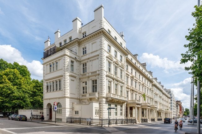
UAV photogrammetry surveys in London can support redevelopment, construction and investment projects where accurate information about existing buildings and sites is required.
London developments frequently involve constrained sites, neighbouring structures and complex existing conditions.
Detailed aerial information can help development teams better understand those constraints before progressing designs.
However, drone operations in London require careful assessment of airspace, nearby people, surrounding buildings, privacy and other site-specific factors.
Competent UAV operators should determine the appropriate operating requirements for each project.
FraserBond.com provides London property sourcing, acquisitions, sales and investment support, while specialist survey professionals can undertake the required UAV photogrammetry work.
UAV Photogrammetry for Property Due Diligence
Drone mapping can form part of broader development and property due diligence.
Before purchasing a large development site, an investor or developer may require detailed information about the land and existing structures.
Photogrammetry can provide valuable spatial information, but it does not replace other investigations that may be required.
These can include planning due diligence, ground investigations, environmental reports, drainage assessments, utility surveys, structural surveys and legal investigations.
Combining accurate technical information with commercial property analysis can provide a stronger basis for an acquisition decision.
UAV Surveys and Development Finance
Technical site information can also support the assumptions underpinning property development finance.
Lenders and equity investors typically expect construction budgets and development programmes to reflect known site conditions.
Unexpected earthworks, infrastructure requirements or physical constraints can increase the project's total development cost - TDC.
Appropriate UAV, topographical and technical surveys can therefore help developers establish more reliable project assumptions before seeking external capital.
Property and Development Support from Fraser Bond
Fraser Bond works with developers, investors, landowners and property companies evaluating opportunities throughout London and the UK.
Through FraserBond.com, clients can access development site sourcing, property acquisitions, sales, lettings, compliance-focused support and investment advisory.
For clients undertaking development due diligence, Fraser Bond can provide location-specific property intelligence while qualified UAV operators, surveyors and engineers deliver photogrammetry, LiDAR, topographical and other specialist surveys.
Visit FraserBond.com to explore UK property and development opportunities and discuss acquisitions, development sites, sales and investment requirements with Fraser Bond.