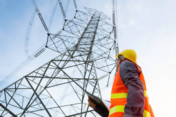
Utility Transmission Survey Solutions UK - UAV, LiDAR and Infrastructure Surveys
Utility transmission survey solutions provide accurate geospatial and asset information for electricity, gas, water and other major infrastructure networks. Across the UK, utility operators, infrastructure contractors, developers and landowners can use specialist surveys to map transmission corridors, inspect assets, identify vegetation risks and support the planning of new or upgraded infrastructure.
Modern utility surveying can combine UAV inspections, LiDAR surveys, photogrammetry, topographical surveys and aerial photography. The appropriate methodology depends on the infrastructure, required accuracy, terrain, access restrictions and intended use of the data.
For developers and investors assessing property affected by utility infrastructure, FraserBond.com provides property sourcing, acquisitions, sales, compliance-focused support and investment advisory across London and the wider UK property market.
What Are Utility Transmission Survey Solutions?
Utility transmission surveys collect spatial and condition information about major utility networks and their surrounding environments.
Depending on the infrastructure and survey specification, information may include:
- Transmission routes and corridors
- Towers, poles and supporting structures
- Overhead lines and conductors
- Pipeline routes
- Ground levels and terrain
- Access routes
- Crossings and neighbouring infrastructure
- Buildings and structures
- Vegetation proximity
- Visible asset condition
Survey data can subsequently support engineering design, inspection, maintenance planning and infrastructure asset management.
UAV Utility Transmission Surveys
UAV utility surveys use drones to capture detailed information across transmission infrastructure and extensive corridors.
High-resolution aerial imagery can support visual inspection of assets that may otherwise be difficult to observe efficiently from the ground.
Depending on the application, UAV platforms can also carry LiDAR scanners and other specialist sensors.
Potential uses include overhead line inspections, corridor mapping, vegetation surveys, construction monitoring and infrastructure condition documentation.
Drone operations around critical infrastructure require competent operators, appropriate risk assessment and compliance with applicable UK aviation, safety, privacy and site requirements.
LiDAR Surveys for Utility Transmission Networks
Utility LiDAR surveys generate detailed three-dimensional point clouds representing infrastructure and its surrounding environment.
For overhead electricity networks, LiDAR can capture information relating to conductors, towers, terrain and vegetation.
For wider infrastructure projects, the resulting datasets can support route and corridor analysis.
LiDAR is particularly useful where understanding spatial relationships is important.
Specialists can analyse infrastructure relative to the ground, nearby structures and vegetation rather than relying solely on conventional two-dimensional imagery.
Overhead Line Transmission Surveys
Overhead line surveys are an important part of electricity transmission and distribution asset management.
Depending on the project, UAV, LiDAR and ground surveys can support assessment of towers, poles, conductors and the wider line corridor.
Survey information may contribute to overhead line design, route assessment, clearance analysis, vegetation management and infrastructure upgrades.
Where engineering or safety-critical conclusions are required, data should be interpreted by appropriately qualified electricity-network and engineering professionals.
Utility Corridor Mapping
A utility corridor survey creates a geospatial record of infrastructure along an extended route.
Corridor mapping can be useful when planning new infrastructure, assessing existing assets or investigating land affected by transmission networks.
Survey information can include terrain, structures, crossings, access and other relevant physical features.
For large corridors, UAV and aerial technologies can improve data collection efficiency, while terrestrial surveying may be used for areas requiring specific levels of accuracy or detail.
Vegetation Encroachment Surveys for Utilities
Trees and vegetation can create significant asset-management considerations around certain transmission infrastructure.
Vegetation encroachment surveys can use aerial photography or LiDAR to identify and map vegetation in relation to utility assets.
Three-dimensional LiDAR information can be particularly useful where specialists need to analyse physical proximity.
Repeat surveys can also support monitoring over time.
Vegetation-management decisions should consider relevant safety, environmental, arboricultural and land-access requirements before remedial works are undertaken.
Photogrammetry for Utility Infrastructure
UAV photogrammetry provides another method of mapping utility infrastructure and surrounding land.
Overlapping drone photographs can be processed into orthomosaics, point clouds and three-dimensional models.
These outputs can support visual documentation, corridor mapping and infrastructure planning.
Photogrammetry and LiDAR are not interchangeable in every application. Where precise measurements of complicated infrastructure are required, the survey specification should determine which technology - or combination of technologies - is appropriate.
Topographical Surveys for Transmission Projects
Topographical surveys provide essential information about ground levels and existing site features for new infrastructure projects.
Accurate terrain information can influence route selection, structure positioning, access design and construction planning.
Depending on the scale of the project, topographical information may be collected through conventional terrestrial surveying, UAV photogrammetry, LiDAR or a combination of methods.
The survey should be commissioned against a clearly defined engineering specification so that the resulting information is appropriate for design purposes.
Utility Transmission Surveys for Property Development
Transmission infrastructure can have important implications for property development and land investment.
A development site may contain or sit close to overhead electricity lines, pipelines or other major utility assets.
Developers should establish the location and implications of this infrastructure before finalising site layouts or acquisition values.
Relevant due diligence may include utility surveys, title investigations, easements or wayleaves, topographical surveys, planning analysis and specialist engineering assessments.
Through FraserBond.com, developers and landowners can access property and development expertise while qualified infrastructure professionals undertake the necessary technical investigations.
Utility Transmission Surveys in London
Utility surveys in London can be particularly important because dense development creates complicated relationships between buildings, roads and existing infrastructure.
Regeneration and major development projects may require detailed understanding of existing utility corridors before design or construction proceeds.
Urban UAV operations can also require additional planning because of buildings, people, airspace and other operational considerations.
Specialist survey providers should determine the appropriate data-collection methodology for each project.
Fraser Bond supports London property acquisitions, development opportunities and investment transactions through FraserBond.com, complementing the technical work undertaken by utility and surveying professionals.
Utility Surveys and Development Due Diligence
Infrastructure should be investigated as part of wider development site due diligence.
A survey may establish where an asset is located, but developers may still need to understand the legal rights, operational requirements and potential costs associated with it.
For example, a proposed development affected by transmission infrastructure may require changes to the masterplan or specialist discussions concerning existing assets.
Early investigation allows these issues to be incorporated into the development appraisal rather than discovered during construction.
Utility Infrastructure and Development Finance
Transmission infrastructure can materially affect property development finance where it changes the developable area, construction programme or infrastructure budget.
Unexpected utility diversions or engineering requirements can increase the total development cost - TDC and reduce anticipated development returns.
Developers should therefore investigate significant utility constraints before finalising projected gross development value - GDV, development profit and external funding requirements.
Reliable survey and engineering information can provide lenders and equity investors with a clearer understanding of the underlying project.
Property and Infrastructure Support from Fraser Bond
Fraser Bond works with developers, investors, landowners and property companies assessing development and investment opportunities throughout London and the UK.
Through FraserBond.com, clients can access development site sourcing, property acquisitions, sales, lettings, compliance-focused property support and investment advisory.
Where land or development opportunities involve transmission infrastructure, Fraser Bond can support the property and transaction aspects while suitably qualified UAV operators, surveyors, engineers and utility specialists undertake the required technical surveys and assessments.
Visit FraserBond.com to explore UK property and development opportunities and discuss acquisitions, land, development sites, disposals and investment requirements with Fraser Bond.