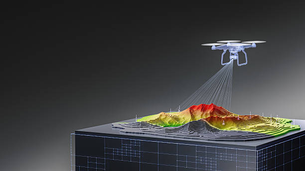
UAV LiDAR Surveys UK - Drone Laser Scanning for Property and Development
UAV LiDAR surveys combine drone technology with Light Detection and Ranging - LiDAR - to capture highly detailed three-dimensional information about land, buildings, vegetation and infrastructure. For UK property developers, investors and landowners, drone LiDAR can support topographical mapping, development feasibility, infrastructure surveys, terrain modelling and property due diligence.
Unlike standard aerial photography, LiDAR uses laser pulses to measure distances and generate dense 3D point clouds. This makes UAV LiDAR particularly valuable for large, complex or difficult-to-access sites where accurate information about terrain and physical features is required.
FraserBond.com supports developers, landowners and investors with development site sourcing, acquisitions, sales, lettings, compliance-focused property support and investment advisory across London and the wider UK.
What Is a UAV LiDAR Survey?
A UAV LiDAR survey uses a drone equipped with a laser scanner and positioning equipment to collect geospatial measurements while flying over a site.
The sensor emits laser pulses towards the ground and surrounding objects. Measurements from the returning signals are combined with positioning data to create a three-dimensional representation of the surveyed area.
Depending on the project and processing requirements, deliverables can include:
- 3D point clouds
- Digital terrain models - DTM
- Digital surface models - DSM
- Contour information
- Topographical mapping
- 3D site models
- Elevation data
- CAD-compatible survey information
- GIS datasets
The required accuracy and outputs should be agreed with a suitably qualified survey professional before data collection begins.
UAV LiDAR Surveys for Property Development
Drone LiDAR for property development can provide developers with detailed information about existing site conditions before design and construction progress too far.
Accurate terrain information can influence building levels, road layouts, drainage, access and earthworks.
For larger development sites, UAV LiDAR can efficiently collect information across substantial areas while creating a detailed digital record for the wider project team.
Architects, engineers and consultants can then use appropriate processed survey data as part of feasibility and design work.
Through FraserBond.com, developers can identify and evaluate UK development opportunities while specialist surveyors undertake the LiDAR and technical investigations required for individual sites.
UAV LiDAR Topographical Surveys
One of the most important applications is the UAV LiDAR topographical survey.
Traditional topographical surveying uses ground-based equipment to measure levels, coordinates and site features. UAV LiDAR provides another method of collecting extensive spatial information from above.
For suitable sites, this can support the mapping of:
- Ground levels
- Slopes and terrain
- Roads and tracks
- Structures
- Earthworks
- Water-related features
- Vegetation
- Development boundaries and surrounding context
Ground survey control may still be required depending on the accuracy specification and intended use.
UAV LiDAR for Vegetated Land
A significant advantage of LiDAR is its usefulness when surveying land containing vegetation.
Standard aerial photography principally records visible surfaces. LiDAR can generate multiple returns from vegetation and, under suitable conditions, provide information that assists specialists in modelling the underlying terrain.
This can make drone LiDAR surveys for woodland, agricultural land and overgrown development sites particularly useful.
Performance varies with vegetation density, sensor specification, flight parameters and site conditions.
Surveyors should therefore determine whether UAV LiDAR can achieve the required ground-point density for the specific project.
UAV LiDAR for Development Site Due Diligence
Developers considering a site acquisition need reliable information about its physical characteristics.
A UAV LiDAR survey can contribute to development land due diligence by providing detailed information about terrain, structures and other physical features.
This can be combined with:
- Planning investigations
- Utility surveys
- Drainage assessments
- Environmental reports
- Arboricultural surveys
- Ecological assessments
- Ground investigations
- Legal due diligence
LiDAR does not determine whether land is commercially viable for development on its own. Instead, it provides technical information that can improve the quality of the wider development appraisal.
UAV LiDAR vs Photogrammetry
UAV LiDAR and drone photogrammetry can both produce 3D survey information, but they use different methods.
Photogrammetry derives geometry from multiple overlapping photographs. LiDAR directly measures distances using laser pulses.
Photogrammetry can produce detailed visual imagery and textured models, making it highly useful for many property and construction applications.
LiDAR can offer advantages where terrain, vegetation or complex geometry makes direct laser measurements particularly valuable.
Some projects combine both technologies, using LiDAR for detailed spatial information and photography for high-resolution visual context.
UAV LiDAR vs Terrestrial Laser Scanning
UAV and terrestrial LiDAR also serve different surveying requirements.
Terrestrial laser scanning captures highly detailed information from scanners positioned on or around the site and can be particularly effective for buildings, façades and internal spaces.
UAV LiDAR captures information from above and can be more efficient for extensive outdoor sites.
A complex redevelopment might use both.
Drone LiDAR could map the wider site and terrain, while terrestrial scanning captures detailed building geometry.
The survey specification should determine the technology rather than selecting a method solely because it is newer or faster.
UAV LiDAR Infrastructure Surveys
Drone LiDAR infrastructure surveys can provide detailed three-dimensional information across extensive assets and corridors.
Applications may include roads, structures, utility-related sites and other infrastructure where spatial mapping is required.
For property-led regeneration projects, understanding existing infrastructure can be important because access, levels and enabling works can materially affect development costs.
LiDAR datasets can support engineering analysis, but specialist infrastructure professionals should interpret the results and determine any necessary interventions.
UAV LiDAR for Construction and Earthworks
UAV LiDAR can also support construction surveying and earthworks analysis.
Repeat surveys can record changes to terrain as a development progresses.
Depending on the survey methodology and required accuracy, datasets may support assessments of cut-and-fill operations, stockpiles and other changes in site geometry.
This can provide developers and project teams with useful digital records.
However, UAV LiDAR should not be treated as a replacement for formal construction certification, building control or lender monitoring where those services are required.
UAV LiDAR Surveys in London
UAV LiDAR surveys in London can support development sites, regeneration projects and complex property acquisitions where detailed external spatial information is required.
London's dense urban environment can make surveying challenging. Existing buildings, constrained access and neighbouring structures can increase the importance of accurate site information.
Drone operations can also face additional considerations involving airspace, nearby people, privacy and sensitive locations.
Qualified operators should therefore assess whether a UAV survey is operationally appropriate and ensure that applicable UK aviation and safety requirements are addressed.
Through FraserBond.com, developers and investors can access London property sourcing, acquisition and investment support while specialist surveyors deliver the required technical surveys.
UAV LiDAR and Property Development Finance
Detailed survey information can also support the assumptions behind property development finance.
Lenders and equity investors typically expect developers to understand the physical constraints and costs associated with a site.
Unexpected earthworks, access requirements or infrastructure complications can increase the total development cost - TDC and reduce projected returns.
Commissioning appropriate technical surveys before finalising a development appraisal can therefore improve cost certainty and help developers present a better-supported project to potential capital providers.
Property and Development Support from Fraser Bond
Fraser Bond works with developers, investors, landowners and property companies evaluating land, development and investment opportunities across London and the UK.
Through FraserBond.com, clients can access development site sourcing, property acquisitions, sales, lettings, compliance-focused support and investment advisory.
For clients assessing development land, Fraser Bond can provide location-specific property intelligence while qualified UAV operators, surveyors and engineers undertake LiDAR, topographical and other specialist technical surveys.
Visit FraserBond.com to explore UK property and development opportunities and discuss land acquisitions, development sites, sales and investment requirements with Fraser Bond.