LiDAR Surveys UK - Property, Land and Development Surveying Guide
LiDAR surveys provide highly detailed three-dimensional measurements of land, buildings and infrastructure using laser scanning technology. For UK property developers, investors, architects and landowners, LiDAR can support topographical surveys, measured building surveys, development planning, infrastructure assessment, construction monitoring and property due diligence.
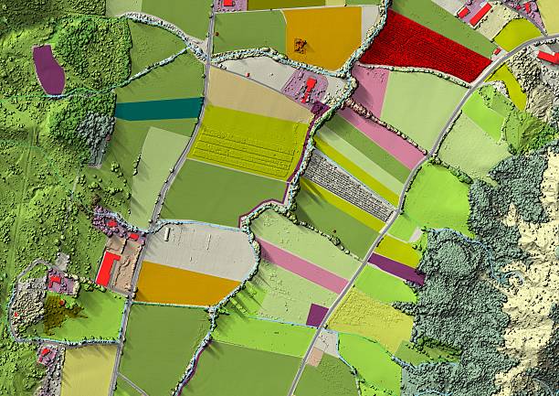
LiDAR - Light Detection and Ranging - can capture millions of measurement points to create a detailed digital representation of a site. Depending on the project, surveys may be undertaken using terrestrial laser scanners, mobile systems or aerial platforms such as drones.
FraserBond.com supports developers, investors and landowners with development site sourcing, property acquisitions, sales, lettings, compliance-focused property support and investment advisory across London and the wider UK market.
What Is a LiDAR Survey?
A LiDAR survey uses laser pulses to measure distances between a scanner and surrounding surfaces.
These measurements generate a collection of spatial coordinates known as a point cloud. The point cloud can represent buildings, terrain, structures and other physical features in three dimensions.
Specialist surveyors can process this information into outputs such as:
- 3D point clouds
- Digital terrain models
- Digital surface models
- Floor plans
- Elevations and sections
- Topographical drawings
- 3D building models
- Survey data for CAD and BIM workflows
The appropriate accuracy and deliverables should be established according to the project's technical requirements.
LiDAR Surveys for Property Development
LiDAR surveying for property development can help architects, engineers and developers establish accurate existing-site information before progressing detailed designs.
This is particularly useful for complicated developments where buildings, changes in elevation or surrounding structures need to be recorded accurately.
A developer considering a conversion, extension or redevelopment can use laser-scanning data to create a detailed representation of existing conditions.
Accurate information early in the development process can reduce reliance on assumptions and help identify physical constraints before substantial design or construction expenditure is committed.
LiDAR Topographical Surveys
LiDAR topographical surveys can capture detailed information about the physical characteristics of development land.
Depending on the methodology, this can include terrain, buildings, roads, structures and other site features.
The resulting information can contribute to feasibility studies, masterplanning and engineering design.
For larger or complicated sites, LiDAR can complement conventional surveying techniques. Ground control and other measurements may also be required where specific levels of survey accuracy are necessary.
Developers should therefore obtain advice from appropriately qualified survey professionals before determining the surveying methodology.
Drone LiDAR Surveys
Drone LiDAR surveys use unmanned aircraft equipped with laser-scanning equipment to collect spatial data from above.
This approach can be useful for larger sites or locations where conventional access is difficult.
Potential property and development applications include land surveys, infrastructure mapping, terrain modelling and construction assessments.
Drone-based LiDAR can also have advantages where vegetation makes conventional aerial imagery more difficult to interpret, although performance depends on the equipment, environment and survey specification.
UK drone operations must comply with applicable aviation, safety, privacy and operational requirements.
LiDAR vs Photogrammetry
LiDAR and photogrammetry can both produce detailed three-dimensional information, but they use different technologies.
LiDAR directly measures distances using laser pulses. Photogrammetry derives measurements and geometry from overlapping photographs.
Photogrammetry can provide highly detailed visual imagery and textures, while LiDAR can be particularly valuable where precise geometric information and detailed point-cloud data are required.
The two technologies can also be combined.
There is therefore no universal answer to whether LiDAR or photogrammetry is better. The correct method depends on site conditions, required accuracy, intended deliverables, programme and budget.
LiDAR Surveys for Buildings and Refurbishments
3D laser scanning is widely applicable to existing buildings.
A detailed point cloud can record complex building geometry before refurbishment, extension or conversion works begin.
This can support projects involving:
- Residential conversions
- Office refurbishments
- Hotel developments
- Mixed-use buildings
- Heritage properties
- Commercial repositioning
- Major extensions
For older or irregular buildings, accurate existing-condition information can be particularly valuable because original drawings may be incomplete or no longer represent the property accurately.
LiDAR Surveys in London
LiDAR surveys in London can be useful for developments where space is constrained and existing buildings or neighbouring structures influence the design.
London development projects frequently involve extensions, infill schemes, conversions and major refurbishments rather than straightforward construction on unrestricted land.
Detailed spatial information can help architects and consultants understand the relationship between the development site and its surroundings.
Through FraserBond.com, developers and investors can access location-specific property expertise when evaluating London development opportunities, while qualified surveyors can provide the specialist LiDAR and laser-scanning services required for technical due diligence.
LiDAR for Infrastructure Surveys
LiDAR is also used for infrastructure inspections and mapping.
Depending on the project, laser scanning can help document roads, structures, utilities-related features and other physical infrastructure.
Accurate 3D information can assist engineers when assessing existing conditions or planning new works.
For large regeneration and mixed-use developments, infrastructure requirements can materially influence construction costs and project viability.
Survey information should therefore be obtained early enough to inform the development appraisal and technical design.
LiDAR for Construction Monitoring
Repeated LiDAR surveys can provide detailed records of a development as construction progresses.
By comparing point-cloud datasets from different stages, project teams may be able to identify physical changes and assess completed work against design information.
This can support construction progress monitoring, quality control and as-built documentation.
However, LiDAR surveys do not replace statutory inspections, building-control requirements, professional certifications or lender monitoring where these are required.
They should instead form part of the wider project information and quality-assurance process.
LiDAR Surveys and BIM
LiDAR data can be particularly useful for Building Information Modelling - BIM.
A point cloud generated from an existing building can provide a basis for creating accurate digital models.
This process is often described as scan-to-BIM.
It can be valuable for refurbishment and conversion projects because designers are working from measured information about the existing asset rather than relying solely on historical drawings.
The required level of detail should be established before commissioning the survey, as more detailed models can require substantially greater processing and modelling work.
LiDAR Surveys for Property Due Diligence
LiDAR can contribute to wider property and development due diligence, particularly where understanding the physical configuration of an asset is important.
Developers can use survey information when evaluating whether an existing building is suitable for redevelopment.
Landowners can use detailed site data when considering development potential.
Investors acquiring commercial or operational properties may require measured information before undertaking major refurbishment or repositioning.
LiDAR should nevertheless be combined with any relevant planning, legal, structural, environmental and commercial due diligence rather than treated as a complete property assessment on its own.
LiDAR Surveys and Development Finance
Accurate technical information can also support the assumptions underlying a property development finance application.
Lenders and equity investors generally expect development budgets and programmes to reflect known site conditions.
Where inaccurate measurements lead to additional structural, construction or infrastructure works, the project's total development cost - TDC can increase.
Early technical surveys can therefore help developers produce more reliable cost plans before approaching lenders or investment partners.
Property Development Opportunities with Fraser Bond
Fraser Bond works with developers, investors, landowners and property companies assessing development and investment opportunities throughout London and the UK.
Through FraserBond.com, clients can access development site sourcing, property acquisitions, investment sales, lettings, compliance-focused support and investment advisory.
For developers undertaking due diligence, Fraser Bond can provide location-specific property insight while appropriately qualified surveyors and engineers deliver LiDAR, topographical, measured-building and other technical surveys.
Visit FraserBond.com to explore London and UK development opportunities and discuss property acquisitions, development sites, sales and investment requirements with Fraser Bond.