Agricultural Surveys Including Crop Health Indices UK - Land and Agricultural Property Guide
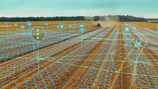
Agricultural surveys including crop health indices use field inspections, aerial imagery, drone surveys and remote sensing to assess farmland, crop condition and variations in plant performance. For UK landowners, farmers, agricultural investors and prospective buyers, these surveys can provide valuable information when managing agricultural assets or carrying out land and property due diligence.
Modern agricultural surveying can incorporate vegetation indices such as NDVI - Normalised Difference Vegetation Index, alongside multispectral imagery, field mapping and other geospatial datasets. Used correctly, these technologies can help identify differences in crop vigour and highlight areas that may require closer investigation.
FraserBond.com supports landowners, investors and buyers with property sourcing, acquisitions, sales, compliance-focused property support and investment advisory across London and the wider UK property market, including clients assessing land and development opportunities.
What Are Agricultural Surveys?
An agricultural survey examines farmland and its physical or productive characteristics for management, investment or due diligence purposes.
The precise scope varies considerably. Depending on the objective, agricultural surveying may incorporate:
- Aerial and drone mapping
- Crop condition assessments
- Multispectral imaging
- Crop health indices
- Topographical information
- Field boundary mapping
- Drainage observations
- Land-use information
- Terrain analysis
- Repeat monitoring
Specialist agronomists, surveyors and remote-sensing professionals may interpret the resulting information depending on the purpose of the assessment.
What Are Crop Health Indices?
Crop health indices are calculated from measurements of how vegetation reflects different wavelengths of light.
Healthy vegetation interacts with visible and near-infrared light differently from vegetation experiencing reduced vigour. Remote-sensing systems can use these differences to produce maps showing variations across a field.
These maps do not automatically diagnose why a crop is performing differently.
A lower index value could potentially relate to several factors, so results normally require interpretation alongside field observations and appropriate agronomic evidence.
NDVI Crop Health Surveys
NDVI - Normalised Difference Vegetation Index is one of the best-known vegetation indices used in agricultural remote sensing.
NDVI uses measurements from red and near-infrared wavelengths to indicate relative vegetation greenness and vigour.
Rather than inspecting an entire field solely from ground level, an NDVI map can make spatial variations easier to identify.
Potential applications include identifying:
- Areas of differing crop vigour
- Uneven crop establishment
- Spatial variability within fields
- Areas requiring further inspection
- Changes between survey dates
NDVI should be interpreted carefully because crop type, growth stage, weather, soil conditions and image quality can affect results.
Drone Agricultural Surveys
Drone agricultural surveys can provide high-resolution imagery across individual farms and fields.
Depending on the equipment, drones may carry standard RGB cameras or multispectral sensors capable of capturing wavelengths used for vegetation analysis.
The imagery can then be processed into maps and datasets showing crop and field conditions.
Drone surveys may be particularly useful when a landowner requires detailed information at a higher spatial resolution than some satellite datasets can provide.
Operations must comply with applicable UK aviation, safety, privacy and land-access requirements.
Multispectral Surveys for Crop Health
Multispectral agricultural surveys capture information across several wavelength bands rather than relying only on conventional visible-light photography.
This information can be processed into different vegetation indices.
Alongside NDVI, specialists may use indices such as NDRE - Normalised Difference Red Edge where appropriate to the crop, sensor and analytical objective.
Different indices can respond differently depending on vegetation density and crop development stage.
Selecting an index should therefore be driven by the agricultural question being investigated rather than treating one measurement as a universal indicator of plant health.
Agricultural Surveys for Farmland Due Diligence
Agricultural land buyers should consider both the property and its underlying characteristics before acquisition.
An agricultural land survey can form part of wider due diligence when assessing a farm, estate or potential land investment.
Remote sensing may provide useful historical or current information about vegetation patterns and field characteristics, while physical inspections can help assess the property directly.
Depending on the transaction, additional investigations may be required concerning soil, drainage, water, access, environmental matters, tenancies, boundaries and planning.
Crop health data should therefore complement rather than replace broader agricultural and property due diligence.
Crop Monitoring Throughout the Growing Season
One advantage of remote sensing is the ability to repeat surveys.
A single crop-health map provides information from one point in time. Multiple surveys can show how spatial patterns change throughout the growing season.
This can help identify areas where crop development is consistently different from surrounding land.
Repeated surveys may support more targeted field inspections and provide a digital record for comparison between periods.
However, meaningful comparison requires consistent data collection and careful interpretation, particularly where weather and crop-growth stages differ between survey dates.
Agricultural Mapping and Precision Farming
Agricultural surveys can form part of a broader precision farming strategy.
Detailed spatial datasets allow land managers to examine variability within individual fields rather than treating an entire field as completely uniform.
Depending on the farm and available technology, survey information can potentially be considered alongside soil sampling, yield mapping, machinery data and other agricultural datasets.
The commercial value of this approach depends on farm size, crop type, management strategy and the quality of the underlying information.
Technology should therefore support agricultural decision-making rather than replace professional agronomic judgement.
Agricultural Surveys for Land Development
Agricultural land can also attract interest from property developers and strategic land investors.
Where land is being considered for future development, agricultural surveying may provide useful information about existing land conditions, but development assessment requires substantially broader due diligence.
Planning policy, access, infrastructure, environmental constraints, ecology, flood risk and other considerations may all influence development potential.
A property's agricultural value and its potential development value should therefore be assessed separately.
Through FraserBond.com, landowners, investors and developers can access property-market support when evaluating land and development opportunities.
Combining Agricultural Surveys with LiDAR and Topographical Data
Crop-health imagery can be combined with other geospatial technologies to create a more comprehensive understanding of agricultural land.
LiDAR surveys can provide detailed terrain and elevation information, while topographical surveys can establish site features and levels.
Photogrammetry can create detailed aerial mapping and three-dimensional surface information.
Multispectral imagery can then add vegetation-related information.
Combining datasets can be particularly useful for larger estates, land-management projects and sites being evaluated for alternative uses.
Agricultural Land Investment and Fraser Bond
Agricultural property decisions require an understanding of both the land itself and the wider investment proposition.
Fraser Bond works with landowners, property investors, developers and investment groups evaluating land and real estate opportunities across the UK.
Through FraserBond.com, clients can access property sourcing, acquisitions, sales, compliance-focused property support and investment advisory.
Where specialist agricultural, crop, soil or remote-sensing analysis is required, appropriately qualified agricultural surveyors, agronomists and technical consultants should undertake those assessments.
Visit FraserBond.com to explore UK property and land opportunities and discuss acquisition, disposal, development and investment requirements with Fraser Bond.