Photogrammetry UK - Property, Construction and Development Surveying Guide
Photogrammetry is a surveying and measurement technique that uses overlapping photographs to create accurate digital representations of buildings, land and infrastructure. In UK property and construction, photogrammetry can support development site surveys, building inspections, 3D modelling, progress monitoring, measured surveys and property due diligence.
For developers, investors and asset owners, the technology can provide detailed spatial information without relying exclusively on traditional ground-based measurement. Drone photogrammetry can be particularly useful for large sites, roofs, façades and locations where conventional access is difficult.
FraserBond.com supports developers, investors and property owners with development site sourcing, acquisitions, sales, lettings, compliance-focused property support and investment advisory across London and the wider UK.
What Is Photogrammetry?
Photogrammetry extracts measurements and spatial information from photographs.
Multiple overlapping images of a building, development site or landscape are captured from different positions. Specialist software identifies common points within those images and processes them into measurable digital data.
Depending on the project, outputs can include 3D models, point clouds, orthophotos, digital surface models and other survey information.
Photogrammetry can be carried out using ground-based cameras or aerial platforms such as drones.
The required survey accuracy, methodology and outputs should be established by appropriately qualified professionals according to the intended use of the information.
Drone Photogrammetry for Property Development
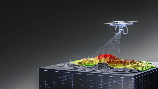
Drone photogrammetry has become particularly useful for surveying development land and existing property.
A drone can capture large numbers of overlapping aerial images relatively quickly, allowing specialist software to reconstruct the site digitally.
For developers, potential applications include:
- Development site mapping
- Land and terrain surveys
- Building inspections
- Roof and façade assessments
- Construction progress monitoring
- Volumetric measurements
- 3D property modelling
- Existing-condition documentation
- Infrastructure inspections
Drone operations remain subject to applicable UK aviation, privacy, safety and site-access requirements.
Photogrammetry for Development Site Surveys
Understanding existing site conditions is essential before committing substantial capital to a property development.
Photogrammetry for development sites can provide detailed information about land, structures and surrounding physical features.
For larger sites, aerial imagery can help development teams understand the relationship between buildings, access routes, terrain and existing infrastructure.
The resulting data can then contribute to architectural, engineering and feasibility work.
Photogrammetry should not, however, automatically be treated as a replacement for every conventional survey. The appropriate surveying method depends on the required accuracy and purpose.
Photogrammetry vs Topographical Surveys
Photogrammetry and topographical surveying can complement each other.
A conventional topographical survey records site features, coordinates and levels using specialist surveying equipment.
Photogrammetry derives spatial information from overlapping imagery and can efficiently capture extensive visual and geometric data.
For some projects, surveyors may combine photogrammetry with ground-control measurements or other surveying technologies to produce the required level of accuracy.
The appropriate method should therefore be determined by the project's survey specification rather than simply choosing whichever technology is faster.
Photogrammetry vs LiDAR
Photogrammetry and LiDAR - Light Detection and Ranging both produce spatial information but use different methods.
Photogrammetry primarily reconstructs geometry from photographs. One advantage is that the captured imagery can provide detailed visual textures alongside spatial information.
LiDAR uses laser measurements to determine distances and generate dense point-cloud data.
Depending on site conditions and project requirements, one technology may be more appropriate than the other, or they may be used together.
For property developers, the decision should be based on accuracy requirements, site characteristics, budget and intended outputs.
3D Photogrammetry for Buildings
Building photogrammetry can create detailed three-dimensional records of existing properties.
This can be useful when assessing buildings for refurbishment, conversion or redevelopment.
Architects and consultants may use captured data to understand external geometry and existing conditions before progressing designs.
Photogrammetry can be particularly valuable for complicated façades, roofs and architectural features that would otherwise require difficult physical access.
For historic or architecturally significant buildings, digital records can also assist with documentation and conservation-related work.
Photogrammetry for Construction Progress Monitoring
Developers can use construction photogrammetry to create repeatable visual records during a project.
Regular surveys can document how a development changes over time and provide stakeholders with a clearer understanding of site progress.
Depending on the methodology, information can also support measurements of earthworks, materials or other physical changes.
For lenders and investors, professional construction monitoring can be an important part of development risk management.
However, photogrammetry should not be treated as a substitute for formal lender monitoring, building-control inspections or professional certification where these are required.
Photogrammetry for Property Inspections
High-resolution imagery can support inspections of areas that are difficult or potentially hazardous to access conventionally.
Examples include roofs, façades, tall structures and extensive commercial buildings.
Drone-based surveys can allow inspectors to examine visible defects without initially requiring scaffolding or direct access to every area.
Potential issues identified through imagery may subsequently require closer investigation by building surveyors, structural engineers or other specialists.
For property investors, these inspections can contribute to wider technical due diligence before acquisition or major refurbishment.
Photogrammetry in London Property Development
Photogrammetry in London can be valuable because many development opportunities involve constrained sites and existing buildings.
Projects can include residential extensions, commercial refurbishments, conversions, infill developments and major mixed-use schemes.
Digital site information can help project teams understand existing conditions before design and construction decisions are finalised.
London's dense urban environment can also introduce operational restrictions for drone surveying. Flight planning, nearby buildings, people, airspace restrictions and privacy considerations may affect whether aerial photogrammetry is appropriate.
Through FraserBond.com, developers and investors can explore London development and investment opportunities while specialist surveyors provide the technical data required for individual projects.
Photogrammetry and Property Due Diligence
Accurate information can significantly improve property development due diligence.
A developer purchasing an existing property for conversion may need to understand the building's external condition and physical configuration.
An investor acquiring a large commercial asset may require detailed roof or façade information.
A land developer may require accurate information about site characteristics before completing feasibility work.
Photogrammetry can contribute to these investigations, but it should form part of a broader due diligence process incorporating relevant legal, planning, structural, environmental and commercial assessments.
Photogrammetry and Development Finance
Survey information can indirectly support property development finance by improving the reliability of project assumptions.
Lenders and equity investors generally want evidence that construction costs, development programmes and property strategies have been properly assessed.
Accurate site and building information can help developers identify potential complications before finalising their budgets.
For example, unexpected site constraints or building conditions can affect the total development cost - TDC, construction programme and ultimately projected development returns.
Technical due diligence can therefore strengthen the information supporting a funding proposal, although the specific requirements will depend on the lender and project.
Property Development Support from Fraser Bond
Fraser Bond works with developers, investors, landowners, landlords and property companies assessing opportunities across London and the UK.
Through FraserBond.com, clients can access development site sourcing, acquisitions, property sales, lettings, compliance-focused support and investment advisory.
For development acquisitions, Fraser Bond can provide location-specific property intelligence while appropriately qualified surveyors, engineers and technical consultants undertake photogrammetry and other specialist surveys where required.
Visit FraserBond.com to explore London and UK property opportunities and discuss development sites, acquisitions, sales and investment requirements with Fraser Bond.